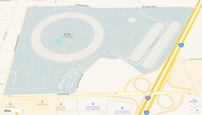
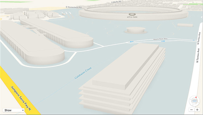
Apple’s spaceship-style campus called Apple Park first appeared on company’s own mapping app, the Apple Maps, in the month of March this year. Now the company has updated Apple Maps with 3D models and detailed maps of its upcoming campus, the Apple Park.

With the latest addition to the Apple Maps, users ow can see the pathways, roads, traffic information, and more leading into the campus. Steve Jobs theater inside the Apple Park has got its own information tag on the Maps, while the Apple Park Campus itself and the other structures are yet to get those information tags. More changes to the Maps over the course of next few weeks are expected to be introduced.
While the Apple’s new campus is reaching its completion, the company is in the process of shifting its employees to the certain areas of the new building. While some parts of the new campus still need finishing touches, Apple will reportedly be moving about 12,000 of its employees to the Apple Park over the course of next six months.
The company is not only building its new campus, it is also going to plant about 9,000 trees around the campus in an effort to further company’s environmental initiatives. The Apple Park concept is said to be the brainchild of the Legendary Steve Jobs himself and the company has worked really hard to make it a reality. The same land where Apple is constructing its Apple Park used to be home to HP’s office.

The company is expected to pay as much attention to the details of the campus as its does to its products. A report on the Apple Park said that the concrete panels that were to be used in the ceilings of the campus had to be approved by Apple’s in-house team twice. This clearly shows company’s dedication and level of attention towards its new home.
Via [Apple Insider]
The post 3D Models of Apple Park Campus have Started to Appear on Apple Maps appeared first on iPhoneHeat.


